Home > Travel > Yellowstone 2000
10/14 | 10/15
|
||
|
Home > Travel > Yellowstone 2000 10/14 | 10/15 |
||
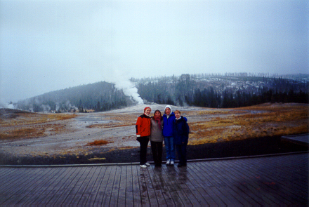
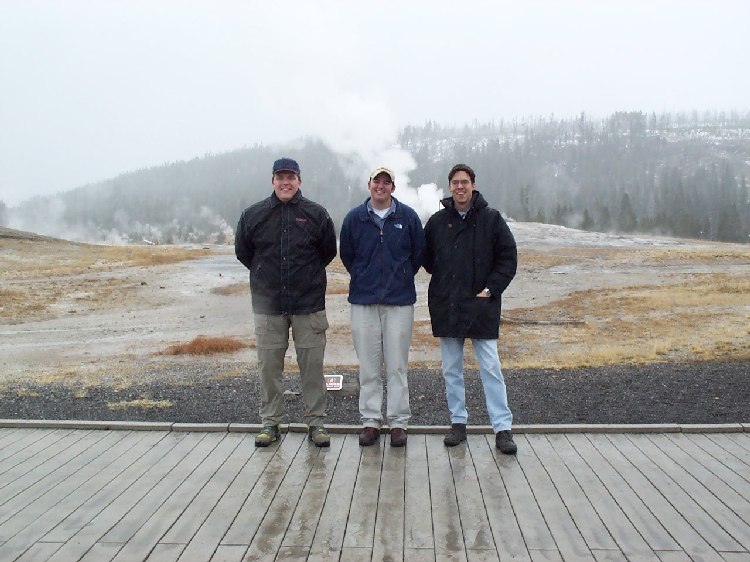
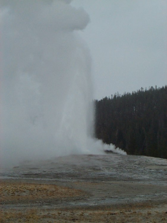
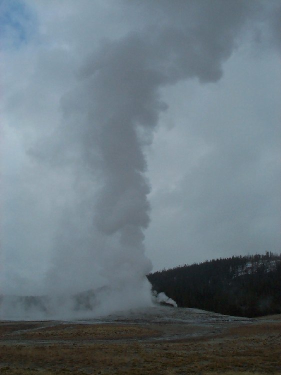
Old Faithful, Midway Basin, Grand Canyon Sunday, 10/15/2000
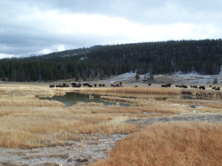
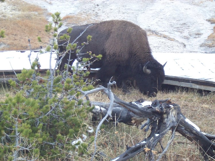
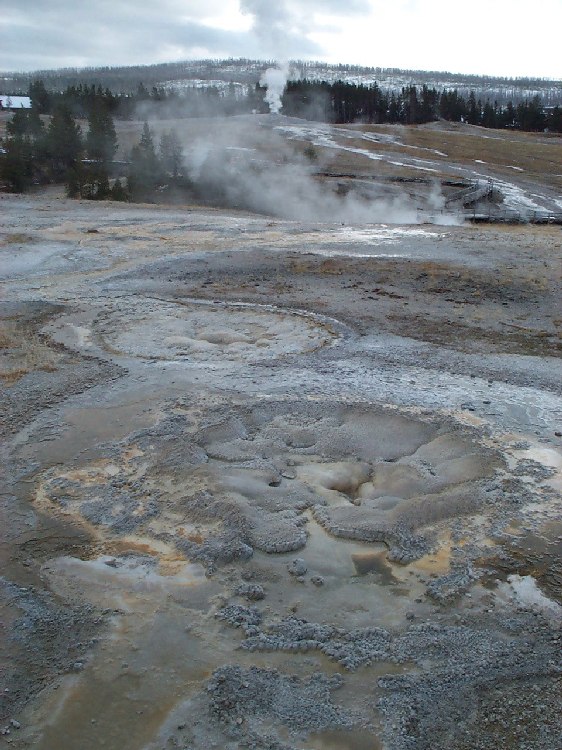
As we move on to Geyser Hill, we find the way blocked by two big bison lazily grazing right beside the boardwalk. Instead of taking any chances by trying to bypass them, we decide to take a cue from them and get something to eat. We return back to the store for breakfast (sandwiches and coffee) and then make another attempt. This time, the way is clear. We cross the bridge over Firehole River and take the loop trail around Geyser Hill. Along the boardwalk, we see all kinds of hot springs and small geysers like Heart Spring and Anemone Geyser, which goes off every five to ten minutes. Some are clear, bottomless pools of faint blueish color, some bubble and sizzle like boiling water. Of others we only see the mound of sediments built up in countless eruptions of mineral-rich water, like the cone of the Beehive Geyser whose unpredictable eruptions reach 33-50 meters (100-150 feet). We don't visit the Upper Geyser Basin, i.e. the Castle-Grand Area, Morning Glory-Riverside Area, Daisy Group or Biscuit Basin since the way there takes a bit long on foot and we still have a lot of stops planned for today (they still are worth a visit - maybe next time...).
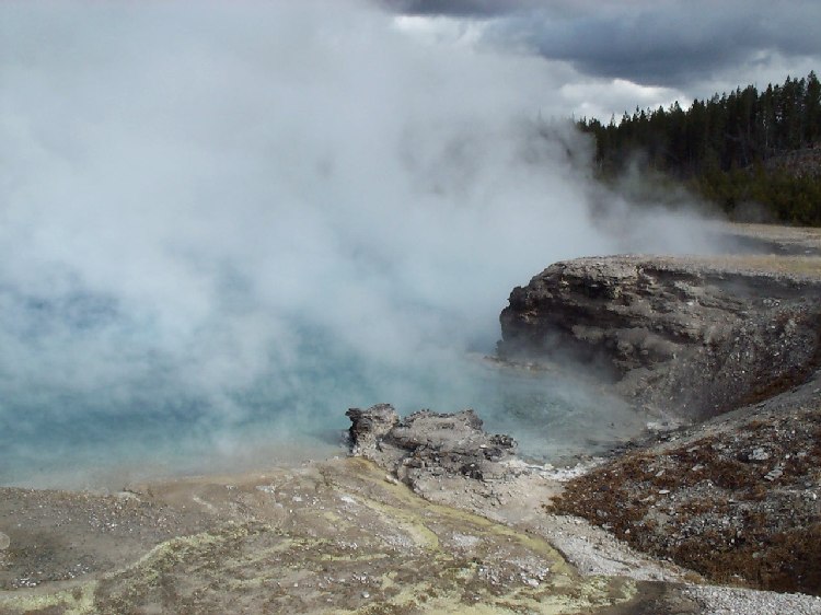
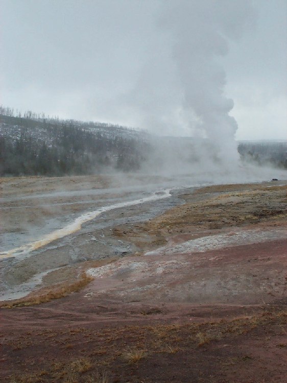
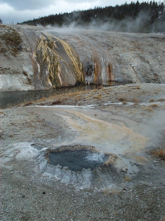
Instead, we drive on to the Midway Geyser Basin, home of Yellowstone's largest hot springs. As we cross the footbridge connecting the parking lot and the thermal area, we see broad rivulets of hot water streaming down the embankment into Firehole River (16,000 liters or 4,000 gallons per minute, to be more precise). Behind the incline, something is steaming so heavily that we only see a white wall of fog instead of individual clouds. We dive right into the fog, getting several good nosefulls of the sulfuric odor we're used to by now, and emerge on the other side to see a boardwalk running halfway around a crater measuring about 66 x 100 meters (200 x 300 feet). We hear what sounds like steam vents and splashing water, but because of the steam, we can barely make out any details. Only rarely do we get a glimpse of a shiny blue surface, penetrated occasionally by small outbursts of bubbles and water. A sign tells us we are standing next to the Excelsior Geyser that ruptured its underground system and carved its huge crater in a violent explosion in the 19th century. However, since Excelsior had several minor eruptions after that time, it is still considered an active but unpredictable geyser. 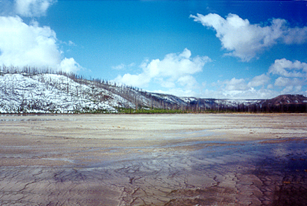
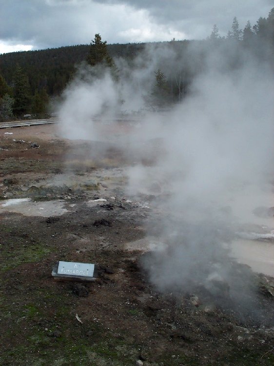
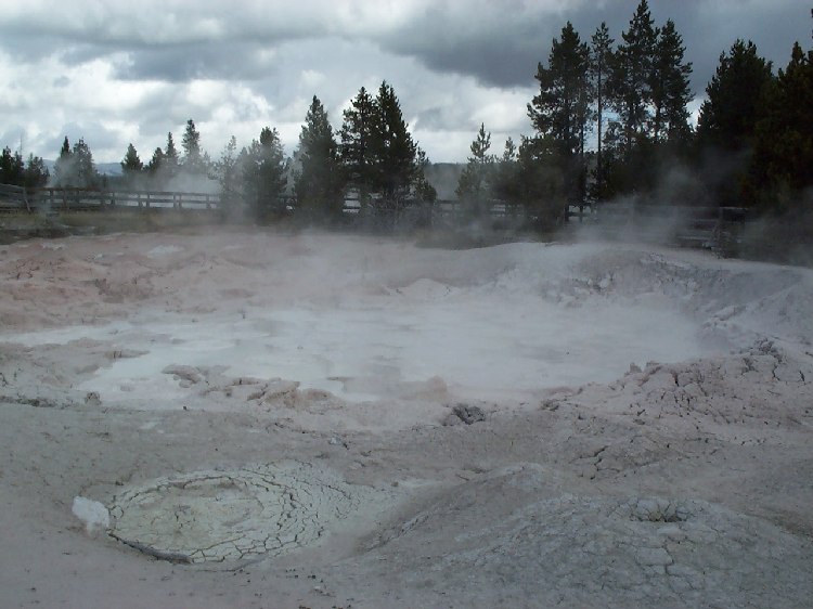
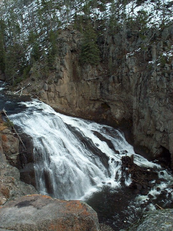
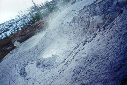
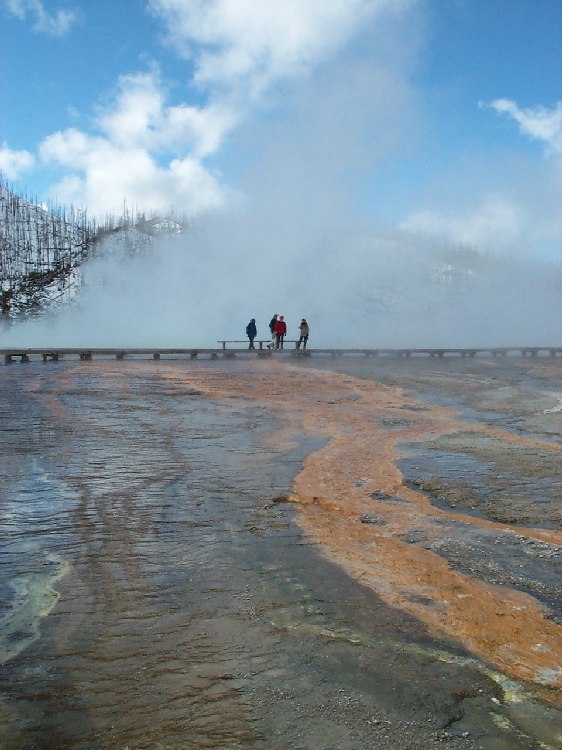
The boardwalk leads us on to Grand Prismatic Spring, a hot spring 123 meters (370 feet) in diameter and more than 40 meters (121 feet) deep. Aerial photographs show it as a huge eye-shaped pool with a dark blue center, fading to turquoise and green at the rim, set in yellow-gray stone covered with feathery orange-brownish bacteria mats. However, the only thing we see is fog again since the hot water is steaming in the cold air. On the way back to the parking lot, we marvel at the far-reaching view of the landscape as we pass by two smaller hot springs with eerie blue tones, aptly named Cyan and Turqoise Spring. Our next stop is Fountain Paint Pot Trail which includes all four types of Yellowstone's thermal features: Quietly steaming hot springs, hissing fumaroles (steam vents), water-spewing geysers and - new to us - mudpots: Gas is slowly rising in a basin filled with thick, grayish mud, forming huge bubbles that burst with a popping sound. The basin's walls are plastered with mud ejected from the bursting bubbles. On our way along the boardwalk we see another small geyser erupting in constant small, two-meter-high jets. We continue on the main road, making short photo stops at Gibbon Falls and Beryl Spring.
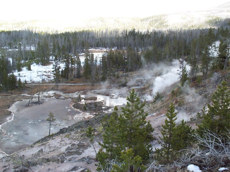
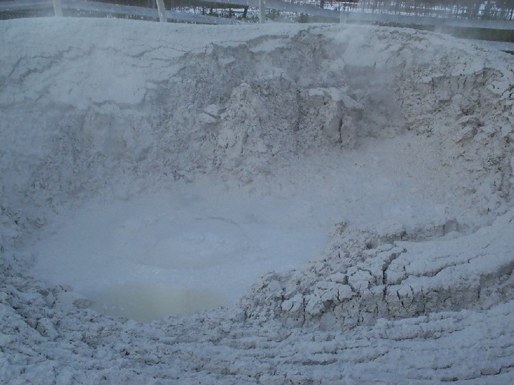
About 4.5 miles south of Norris on the east side of the road, we reach the small, easily-overlooked parking lot for Artist Paint Pots. The boardwalk leads us into a partially burned lodgepole pine forest. Here, the trail is just a narrow, snow-covered path winding between the trees - a fun change after all those wooden boardwalks. After about a half mile, we reach a clearing with lots of small, hot springs colored in white, red, brown or blue tones. The path leads up a short, steep incline which offers not only a great view over the clearing with its paint pots, but also features some fumaroles surrounded by brightly orange-colored rock and a busy mudpot. In some hot spots, bubbles surface at the same position again and again, spewing mud as high as one meter into the air, seemingly aiming at each other. Even the ground we are standing on is covered with the gray stuff, making us cautious for flying mud bombs.
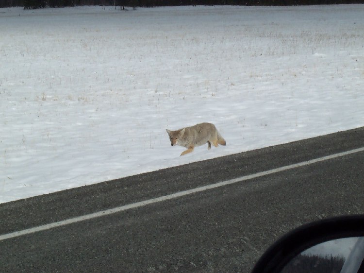
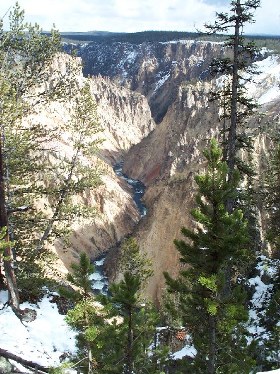
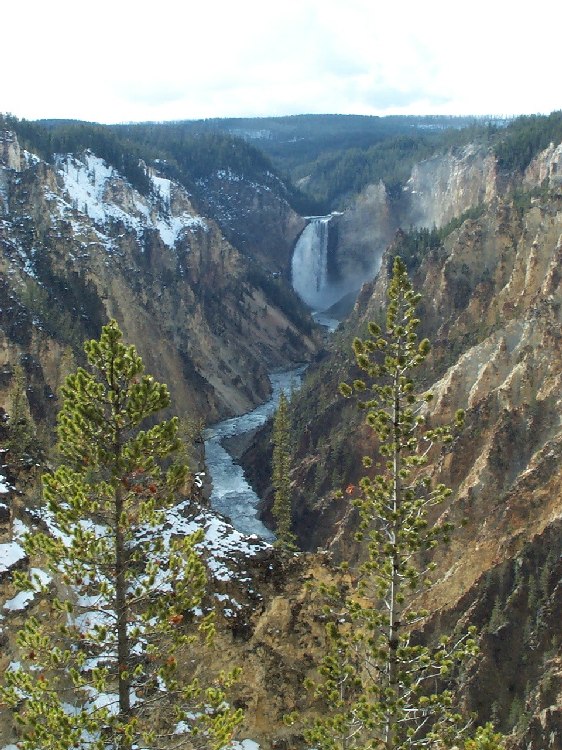
After this stop, we drive on to Norris where we turn east to Canyon Village. The road leads through a beautiful, partially snow-covered forest. We're excited to see a coyote trodding along the roadside, not really minding our presence. At Canyon Village, we take the one-way road leading along the canyon rim. We stop at a turnout with a viewpoint sign, step out onto a platform and are overwhelmed by the panorama lying before us: Yellowstone River carved a V-shaped canyon with walls of yellow rock into the forested land. The canyon is about 32 km (20 miles) long, 266 to 400 meters (800 to 1,200 feet) deep and 500 to 1,333 meters (1,500 to 4,000 feet) wide.
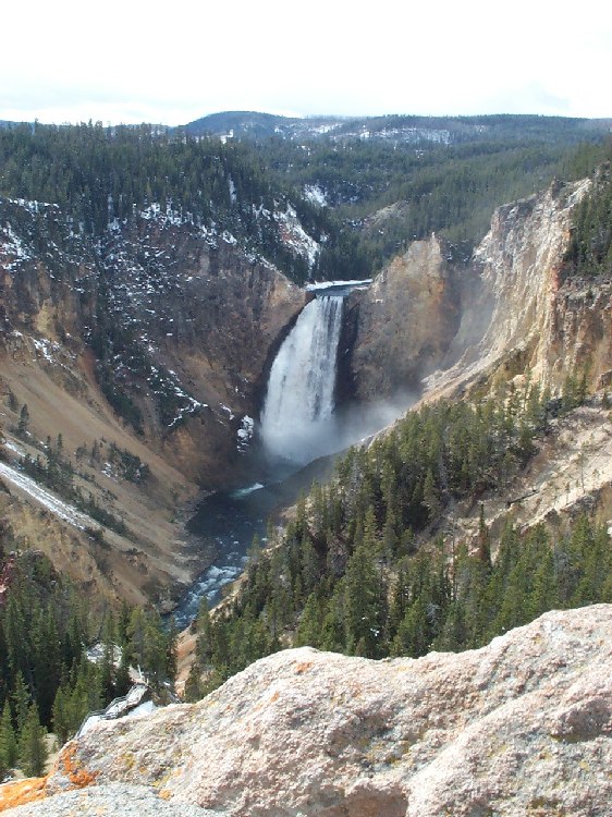
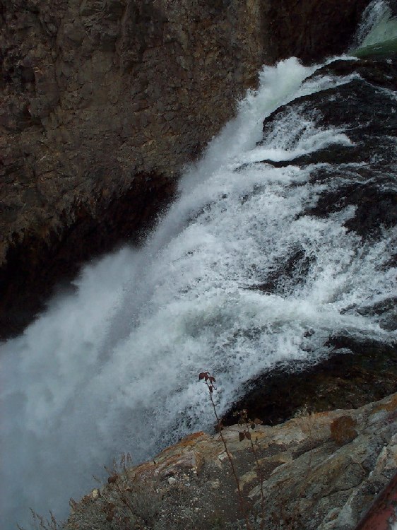
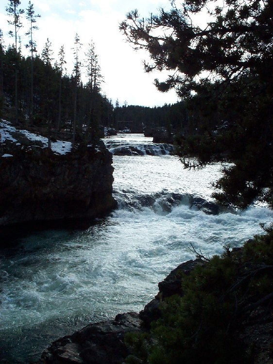
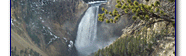
The next viewpoint is even more magnificent - we look on the massive, 102 meters (308 feet) high Lower Falls that marks the end of the Grand Canyon of the Yellowstone. Depending on the season, the volume of water flowing over the falls varies between 15,875 and 1,250 liters (63,500 and 5,000 gallons) per second. At the edge of the falls, we see a small observation platform dwarfed by the scale of the water sheet. The trailhead of the path leading to that platform is just a few minutes down the road. On the way down the paved, zig-zagging trail we catch a first glimpse of the Upper Falls which we will visit later. Then, we step out onto the platform and are stunned by the view right in front of us: The clear, relatively calm stream of water flowing towards the edge is torn into a chaotic, roaring spray of white droplets as it plunges over the rocks into the foaming pool deep below. Almost hypnotized by the view, we lean over the railing for several minutes before we walk back to our van.
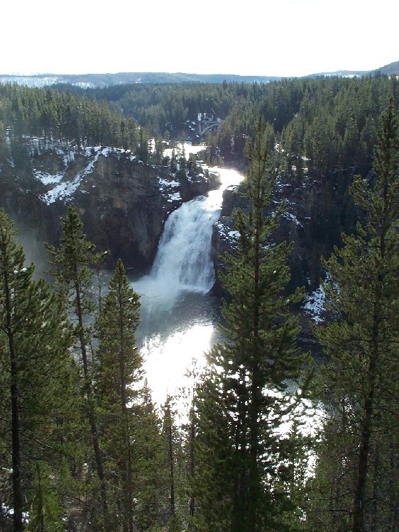
As the one-way scenic road hits the main road again, we turn south in order to visit the Upper Falls of the Yellowstone River. Shortly after, we take a left turn into a small side road that leads to the edge. Although only 36 meters (109 feet) high, the Upper Falls are still an impressive sight. To see the canyon from the southern rim, we take the road to Artist Point. From the trailhead of Uncle Tom's trail, we have another nice view of the Upper Falls. Our final stop is Artist Point: From this platform jutting out into the canyon, we enjoy the breathtaking view that has become the symbol of Yellowstone National Park: Behind a foreground of green trees, the partly snow-covered, partly yellowish canyon walls frame the Yellowstone River winding down from the Lower Falls in the center of the vista.

After this last highlight, we drive back to the North Entrance without further stops. Since it's the end of the season, there aren't many other cars on the road. The few cars we encounter drive slowly, giving us time to take in the view of the landscape transitioning from fall to winter. Passing through Gardiner, we finally leave Yellowstone National Park behind us and head home. After dinner in a Subway in Livingston, we drop Nils off at his Quad on the MSU campus in Bozeman. As we drive back to Missoula listening to Finnish pop music, we are hard pressed to name the highlight that impressed us most - be it the mudpots, the canyon or the hilarious slang-teaching session in the Old Faithful Lodge. |